|
I talk in my photo workshops about various kinds of photography.
One venerable class is "street photography," which itself I divide
into three sub-classes -- artistic, documentary and journalistic.
I am usually an artistic street photographer (see the
Travel & Vacation section).
For a change, this page describes a trip's photography that is
better characterized as documentary; at least, I've structured
the page as a chronological narrative rather than a set of
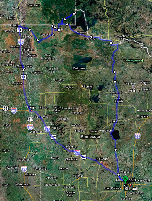
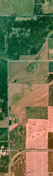
individual photos. In early October 2009, partly out of boredom and partly to seek some new photographic opportunities, I visited Minnesota's northern border. My wife was laid up in Michigan with a broken ankle, there were no pets to care for, so I just set out on a drive north. Day 1 First stop was an overnight stay with my friend Dave in Marcell, MN, north of Grand Rapids, about 4-1/2 hours drive north of the Twin Cities. Incidentally, as I approached Marcell two grey wolves ran across the road in front of me -- a quite impressive sight, although come and gone before any chance to raise camera and take a photo. Day 2 The next morning I set off, driving north toward Baudette. This was the second of four days for my loop, which may be seen in the map below. |
| On the way to Baudette I stopped momentarily in Bigfork (just north of Marcell), taking advantage of cell coverage to call my wife, but meanwhile also to capture a Sunday morning religious procession. |
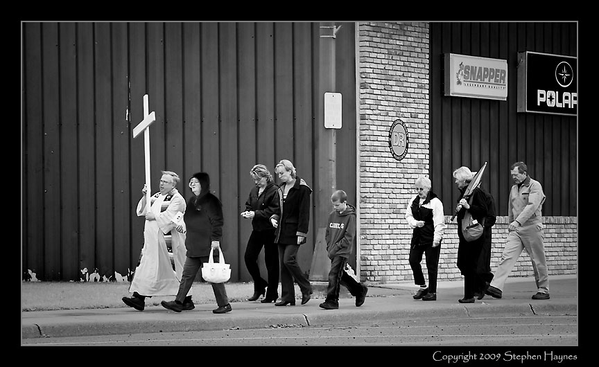
Small Congregation
|
My trip's principal purpose was to experience the Borderland, and incidentally to photograph certain portions of this far-northern stretch of land. (I say "far-northern" while fully conscious that it all lies south of a major Canadian metropolis, Winnipeg.) This, after all, is widely known as the longest undefended border in the world. I wanted to see what that looked like. My first chance came on Route 11 between International Falls and Baudette. |
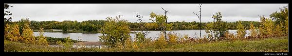
|
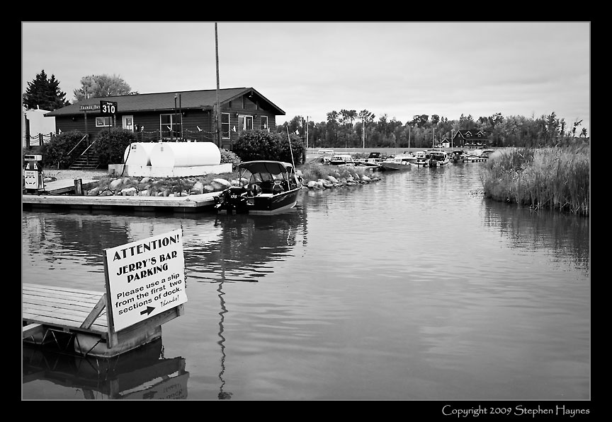
(The above is a thumbnail -- click to see the full-sized panorama -- close to return here.) A portion of the Rainy River. On the far bank, Canada. No fence. No guard towers. No river patrol. Put a canoe in the water here or there and just paddle across. (By the way, this is the first of multiple photos with no sun. The skies were uniformly overcast throughout most of the trip, with rain part of the time. Had the weather been better, I might have become more enthusiastic about the photography.) Baudette is the self-proclaimed walleye capital of the world (for the uninitiated, a "walleye" is a game fish renowned in Minnesota for its white flesh that can substitute for cod in fish & chips, or even for sole in some dishes). No, I did not take a photo of "Willie Walleye," the very large walleye statue on the town's east side. After exploring Baudette to discover lodging options (I stayed the night in an AmericInn facility -- which included high-speed Internet access), I stopped at a local diner for lunch. Walking in, I discovered the dress code for Baudette was identical to that observed everywhere in Minnesota -- work attire with the ubiquitous baseball caps. After lunch, I set out to visit Wheelers Point, where the Rainy River flows into Lake of the Woods. Several photos taken during the drive: |

Abandoned Schoolhouse
(north of Baudette)
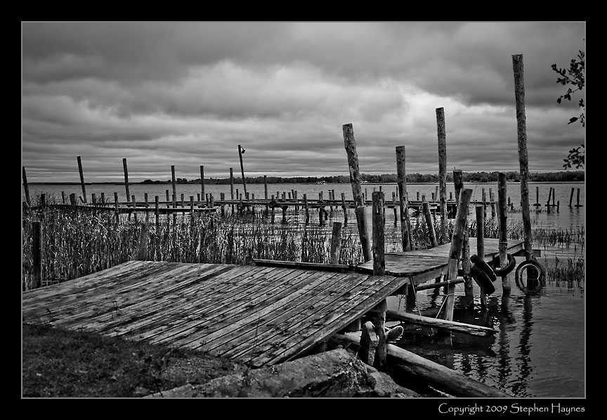
Rickety Dock
(Wheelers Point - mouth of Rainy River)
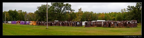
Waiting for the Ice
(Ice Houses waiting for the lake to freeze)
(Click image to see full-sized -- close to return here)
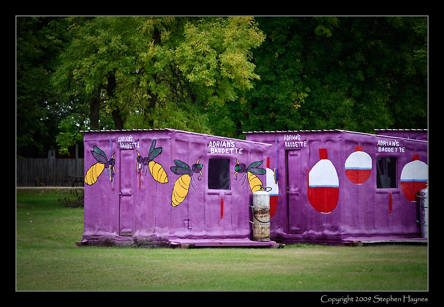
Adrian's
(You can never have too many ice houses)
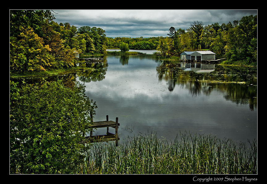
Rainy River Lagoon 1
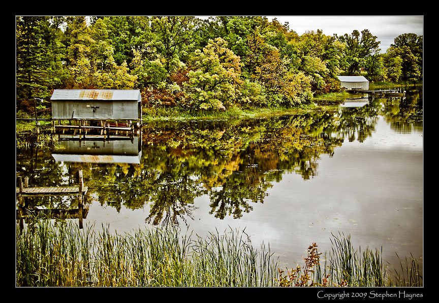
Rainy River Lagoon 2
|
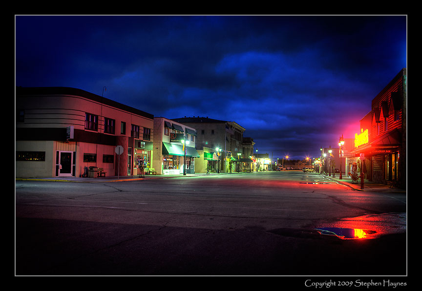
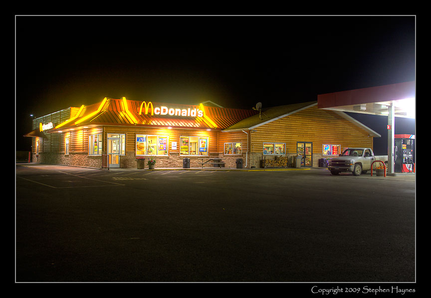
Returning to Baudette, I checked in for the night. I had hoped to eat in a Chinese restaurant seen in the two block-long downtown, but when I ventured out for dinner, I found this: |
Do
They Roll Up the Sidewalks?
(Downtown Baudette, Sunday night)
|
So, instead this: |
|
Day 3 The day dawned with high clouds and no rain. I set off for Warroad, nearly at the Canadian border and home of Marvin Windows. A few photos on the way: |
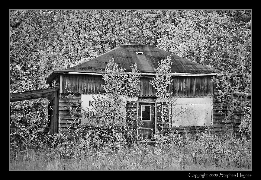
Knives and Wild Rice
(The market's been soft for a long time)
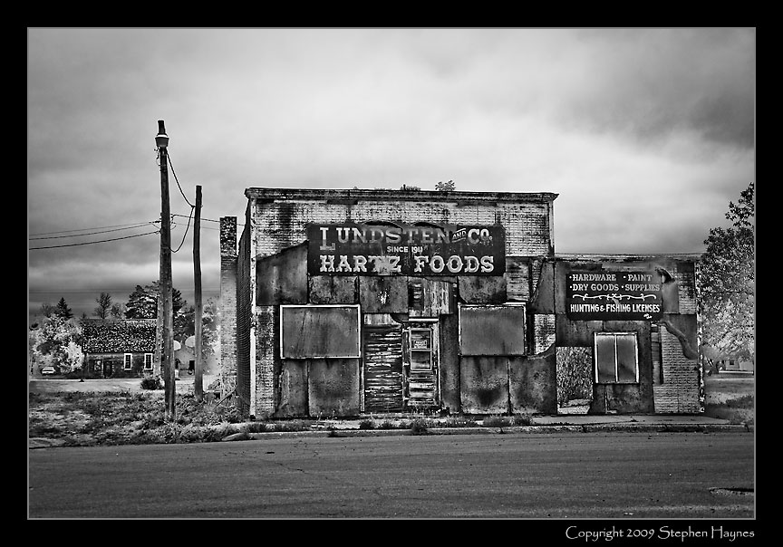
Lundsten & Co.
(Businesses come and gone)
|
At Warroad I faced a binary decision: to continue west, staying within the U.S., or to do something different. I opted for the different: I crossed over into Canada, resolved to visit the Northwest Angle, a peculiarity that resulted, believe it or not, from the 1783 Treaty of Paris that settled the Revolutionary War. Seemed Benjamin Franklin for some reason wanted this odd little lake-land protuberance that runs north of anything else in the continental 48. (Actually, I'm making light, and taking liberties, with history. Read the Wikipedia entry linked to above for the story, including how little Franklin and his contemporaries actually knew.) Problem is, by land you must pass through Canada to get there. I won't detail the oddities involved with re-entering U.S. territory (also part of Minnesota) with no customs or immigration, or then re-entering Canada upon exiting. (Short version, you call in on a videophone.) The small year-round community of Angle Inlet is most attractive to fishers and hunters -- not much there in the way of picturesque photography. I did think this had a bit of humor, however: |
When Ya Gotta Have A Drink
(Where is the Overflow Parking?)
|
I
ate lunch at a nice diner/bar in Angle Inlet, and talked briefly
with the proprietress, who told me they are open all but two weeks
of the year, that elementary school kids went to school in the
Angle, but high school students were bussed to Warroad each day, and
that their groceries were trucked in from Grand Forks, North Dakota.
It's a different life, but apparently not that bad (satellite TV,
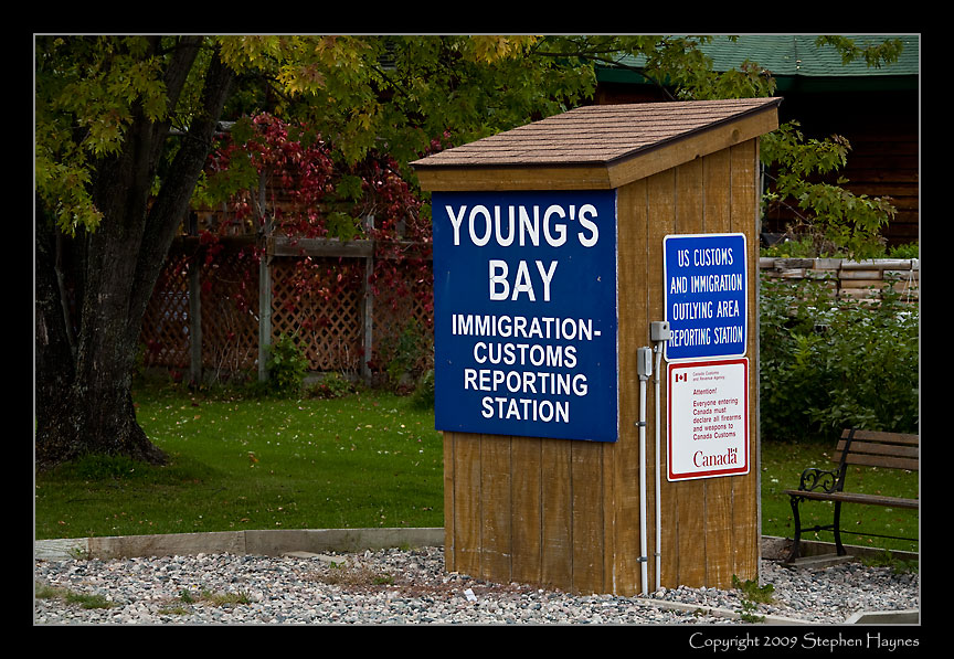
telephone, some form of internet access, etc.) Just in case you were dying of suspense, this is one of about three locations where you can check in with U.S. or Canadian immigration/customs: |
No
Tour Busses Here
(What Happens If You are Denied Entry?)
| On the way in and out of the Northwest Angle, I saw an eight-point buck and several does, including this one: |
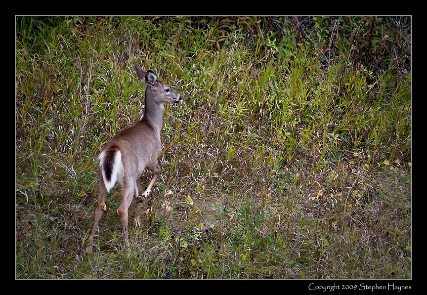
Not Scared of Hunters, Yet
(Watching Them for Five Minutes While They Grazed)
| Departing Canada, I had one other task to complete: to view the border as it passes through rural land. I wanted to see what this demarcation looked like. What does an "undefended border" look like? So, from my re-entry point I drove south, and then a bit west, and then north again to within a slightly more than a mile of the border, then west on a rural road, and finally north again, following a gravel road, and then a jeep trail (remember, this was in my BMW M3, with virtually no clearance and no 4-wheel drive) until the trail took a 90-degree right turn. Could this be the border? Turns out it was. (Click on the map to see the larger version; close to return here.) |
| There it was: a simple miniature obelisk, showing "United States" on one side, "Canada" on the other, and noting "Treaty of 1908" (which apparently refers to the treaty establishing a means for surveying and erecting these markers). That and a two-strand wire fence. That's the border. Underwhelming in its way, but testimony to a pre-9/11 level of trust. |
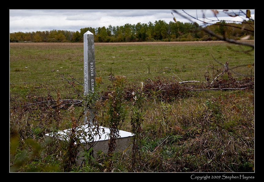
The Border
(Yes, Really, That's It)
| Here was my situation: |
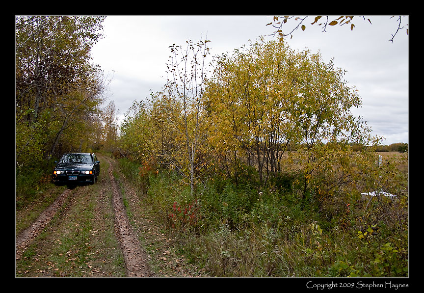
Where To Go From Here?
(BMW where no BMW had gone before)
|
I
didn't want to go forward, since I didn't know if the track would
end. So I backed up several hundred yards, being careful to
stay on the high ground -- sinking into the ruts would have been
disastrous, not to mention a long walk and an embarrassing
explanation. This final photo, below, is typical of so many churches observed in rural northern Minnesota -- a lone church set out in the middle, it seemed, of nowhere. |
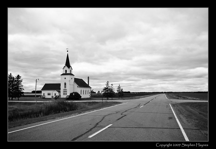
Is
God Lonely Out Here?
(It's Gotta Be Here For A Reason)
|
After my visit to the border, I headed west. Northwestern Minnesota is rich farmland with no photographically redeeming features. Had I more time, I should have settled into one of the small towns and engaged in portraiture -- surely that would have been interesting. The land itself was not. Flat, with farms spaced regularly as squares on a checkerboard. Land to drive through quickly. (Very important, however, for its rich, black soil.) Which I did, heading for the very farthest corner of the state. There, I crossed over into North Dakota, picked up I-29, and drove south to Grand Forks for the night. Day 4 Tuesday dawned gray and wet. I could have taken a more scenic route back to the Twin Cities, but viewing lakes and woods through constant rainfall just did not appeal. So, I sped south to Fargo, then east on I-94 to Minneapolis, with no further photography. |